Paris Region Outline Map PNG
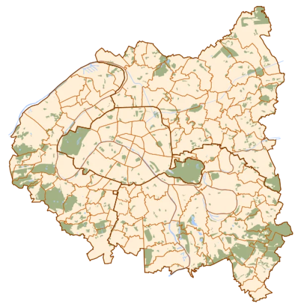
Paris Region Outline Map PNG
Description
Download this free Paris Region Outline Map PNG with a transparent background — perfect for illustrating geographic data, designing travel guides, or creating educational materials about French geography. This high-quality map cutout clearly displays the administrative divisions and key features of Paris and its surrounding region, offering a clean and versatile asset. It is ideal for cartographers, graphic designers, educators, and travelers looking to visualize the intricate layout of the French capital and its metropolitan area. Use it in presentations, websites, infographics, print media, or digital art projects to add a touch of authentic regional detail. Every PNG on pngtemplates.com is royalty-free and ready for commercial or personal use.
PNG keywords
PNG info
Dimensions
500x511px
Filesize
184.38KB
MIME type
Image/png
Resize PNG
width(px)
height(px)
Relevant png images


.webp)